
KAUFMAN COUNTY, Texas — Light snow is possible in North Texas with an arctic cold front’s arrival on Saturday, according to the National Weather Service (NWS) in Fort Worth, Texas.
KAUFMAN COUNTY, Texas — Light snow is possible in North Texas with an arctic cold front’s arrival on Saturday, according to the National Weather Service (NWS) in Fort Worth, Texas.
“Another arctic cold front is expected to move through the area on Saturday afternoon/evening causing temperatures to fall from the 60s and 70s into the 20s and 30s,” stated the NWS.
“After the front moves through, some light snow will be possible north of Interstate 20 on Saturday evening and into the overnight hours,” the NWS stated.
Sunday, temperatures are expected to remain cold with highs in the 20s and 30s and wind chills in the teens and possibly as low as single digits, according to the NWS.
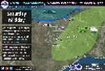
A graphicast, released by the NWS, shows the light snow potential just northwest of Kaufman County. Its unknown if the snow potential will extend to Kaufman County as the forecast evolves going into the weekend.
Before the arctic cold front arrives, some drizzle is possible tonight through Thursday morning across the region.
“Temperatures in our northwest counties may fall to freezing, and if drizzle occurs during this time, a brief period of freezing drizzle may lightly glaze elevated and exposed surfaces, including bridges,” stated the NWS. “Otherwise, we do not expect significant impacts due to any freezing drizzle.”
Thursday morning temperatures are expected to start in the low 30s to mid 40s.